
Maps of New York City - 20th Century
New York continued its progressive era in 20th century. It became the richest city and the financial center in the world, home of a huge number of corporate headquarters, the United Nations Headquarters, and unparalleled cultural center. In 1900, New York City's population was 3,4 million and grew to 8,0 million in 2000.
In the early 20th century, the City's magnetic environment continued to attract a growing and culturally diverse population, many industrial workers were women, working in the textile industry. The transit system grew exponentially and the first subway line opened in 1904, boosting the city's development north of Lower Manhattan.
More maps and panoramic views of NYC:
• Maps of NYC - 17th Century ►
• Maps of NYC - 18th Century ►
• Maps of NYC - 19th Century ►
• Bird's Eye Views of New York ►
• 20th Century Skylines of NYC ►
More: Historical maps of United States ►
◄ Maps NYC
Maps and Panoramas of New York City - 20th Century
1902 - Skyline of New York from Hudson River by Irving Underhill
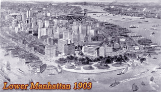
1903 - Lower Manhattan, aerial image, Moses King
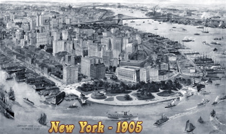
1905 - Aerial image of New York (Lower Manhattan) by Richard Rummell
1905 - Greater New York, illustration by Charles Hart
1906 - Lower Manhattan from balloon, P.F. Collier & Son
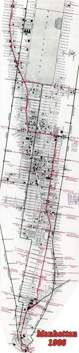
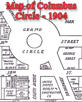
1906 - Map of Manhattan, Merchants' Association Hotel, Theater, Subway
1908 - Manhattan Skyline from Jersey City by Geo. P. Hall & Son
1909 - New York City from a balloon, drawing based on photograph
1910 - Manhattan Skyline from Jersey City, by Geo. P. Hall & Son
1910 - Both Sides of Broadway from Bowling Green to Central Park
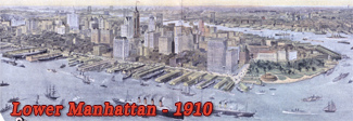
1910 - Lower Manhattan, aerial view by Richard Rummell
1911 - Fifth Avenue from Start to Finish, by Welles & Co. Photographs
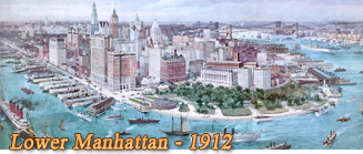
1912 - Aerial image of Lower Manhattan, Richard W. Rummell
1915 - Map of Manhattan, Rider's Guide
1915 - Lower Manhattan, bird's-eye view, Detroit Publishing Co.
1921 - New York Skyline from Jersey City, photograph
1922 - Aerial photograph of Manhattan
1924 - Aerial photo of the Southern Tip of Manhattan
1928 - Map of Tip of Manhattan, Mapdraft Co.
late 1920s - (West side) New York City from New Jersey
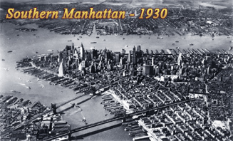
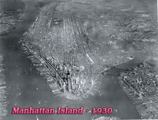
1930 - Aerial Photograph of Southern Manhattan
1931 - Skyline Lower Manhattan from Brooklyn, Irving Underhill
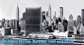
1931 - (Skyline West side) Midtown Manhattan, by Irving Underhill
1932 - Photograph of Midtown Manhattan, Aerial Explorations
1933 - Looking north from the Empire State Building, photograph
1945 - North Manhattan, view from Empire State Building
1964 - Skyline of Lower Manhattan, by Anthony Angel
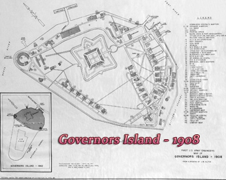
1973-1985 - Skyline of Manhattan from Governors Island
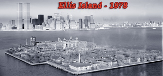
1978 - Skyline of Manhattan from Ellis Island
1990s - Aerial photos of New York City
More: Aerial Views of Lower Manhattan ►


Maps of New York City - 20th Century

|
Copyright © Geographic Guide - Cartography, Historical maps of NYC. |
State of