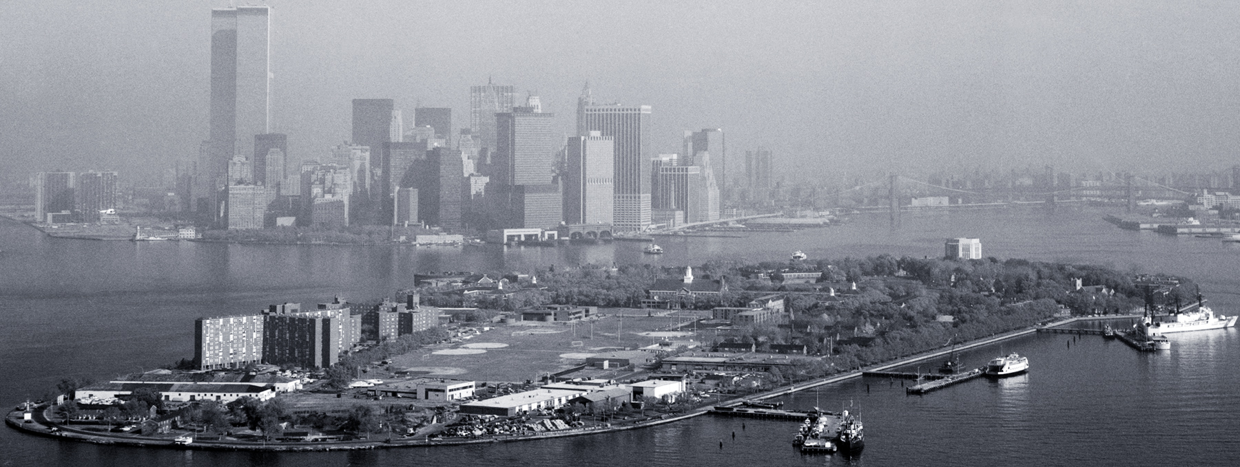
Governors Island - 20th Century
Aerial view of Governors Island, looking north, with skyline of Lower Manhattan in the background and a partial view of the Upper New York Bay. Photograph taken from helicopter for the Historic American Buildings Survey / Library of Congress, between 1973 (Twin Towers) and 1985 (Three World Financial Center and 32 Old Slip, 1986, missing in the photo).
Defense works on the Island can be dated with certainty as early as 1776. A major earthen work was constructed in the 1790s and later demolished. The present fortification, Fort Jay, a square four bastioned fort, and Castle Williams, a circular casemated work, erected under the Second American System of fortifications in the years preceding the War of 1812, were two of the harbor's largest defense works. Both structures, are fine examples of their types, exhibit excellent design and they are among an important and innovative period of American military construction. Both structures are on the National Register of Historic Places. The island is also significant for its role as a major Army administrative center for nearly a century. Beginning in 1878 when the Military Division of the Atlantic and the Department of the East were transferred to the Governors Island, the post served as headquarters for major Army commands until 1966.
More: New York Skyline in 1964 ►

Between 1973 and 1985
|
Copyright © Geographic Guide - Maps of NYC. |
Governors Island - 20th Century
