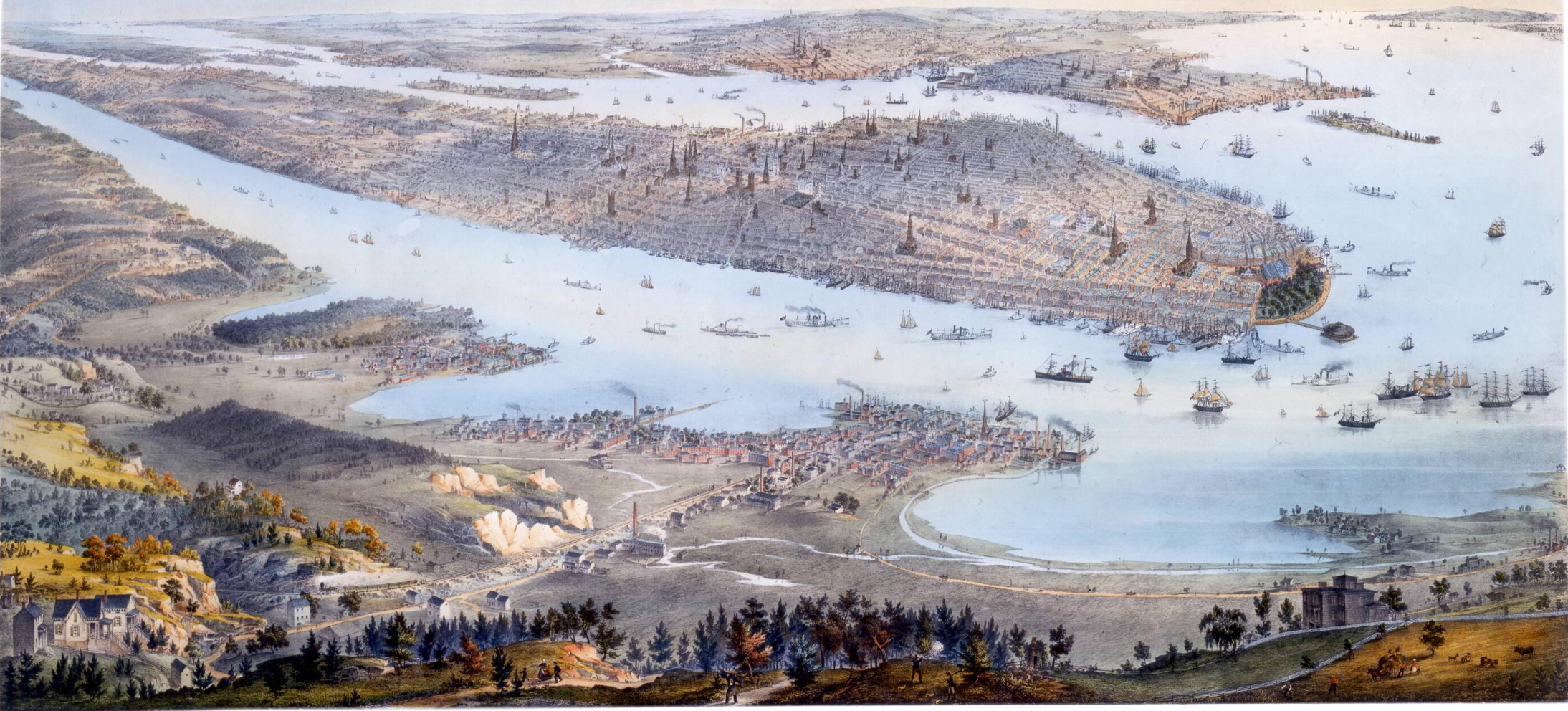
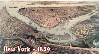
Panorama of Manhattan Island - 1854
Original title: Panorama of Manhattan Island - City of New York and Environs. Hand-colored lithograph with tint border on paper. Drawn from nature & on stone by John Bornet. Printed by Nagel & Weingärtner, N.Y. Published by Goupil & Co. (New York) in 1854. Source: New-York Historical Society Library.
New Jersey in the foreground, Manhattan in the Center and Brooklyn, Westchester County, Long Island and Staten Island in the distance. New York hosted the Exhibition of the Industries of All Nations, which opened on July 14, 1853 and closed on November 14, 1854.
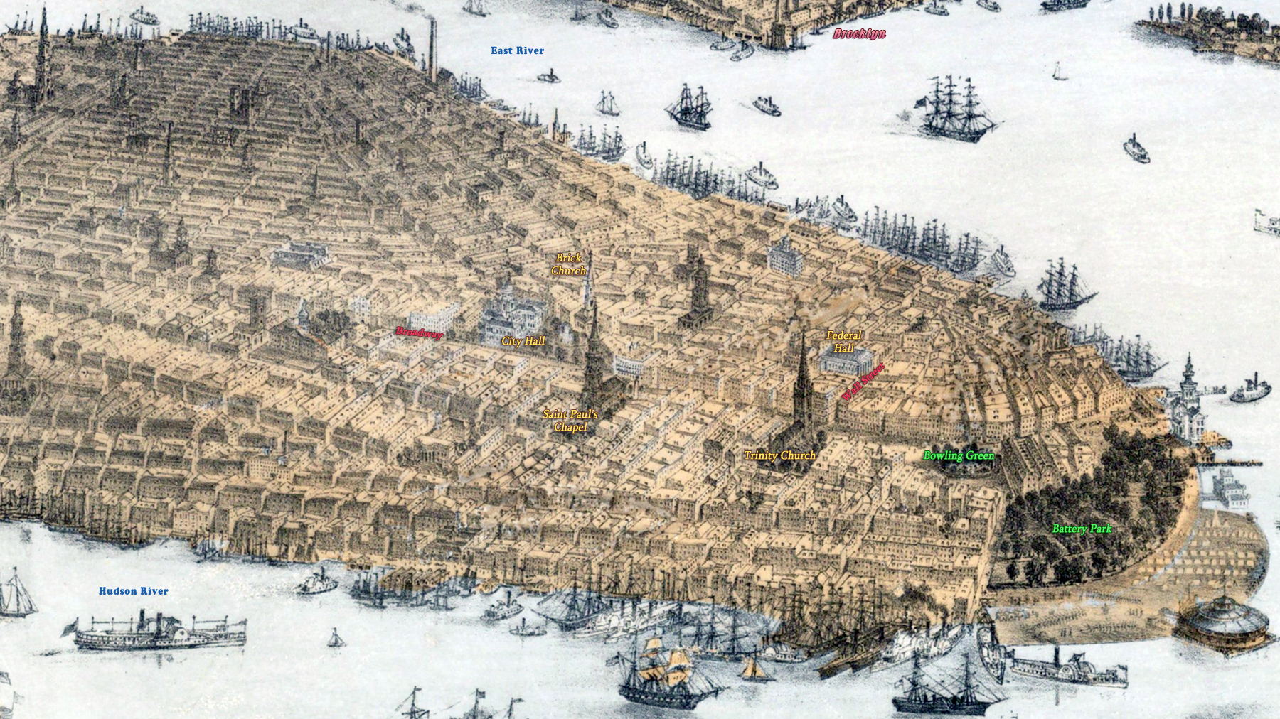
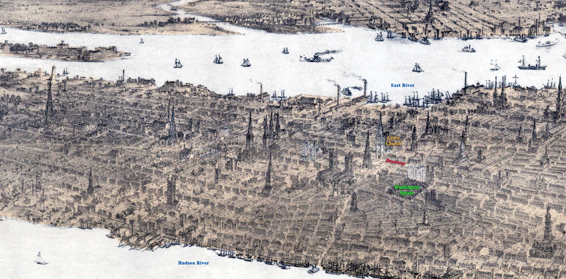
Below, enlargements from another copy of the same drawing, but by Barry Lawrence Ruderman Antique Maps Inc.
More: Maps of NYC - 19th Century ►

|
Copyright © Geographic Guide - 19th Century NYC. |
Enlargement of Midtown Manhattan. On the left, the tower of Latting Observatory, Croton Reservoir and Crystal Palace constructed for the Exhibition of the Industries of All Nations, opened on July 14, 1853 and closed on November 14, 1854.
The Latting Observatory was located on the North side of 42nd Street, between 5th Avenue and 6th Avenue, across the street from the site of present Bryant Park.
Enlargement of Lower Manhattan.


Panorama of Manhattan Island - 1854