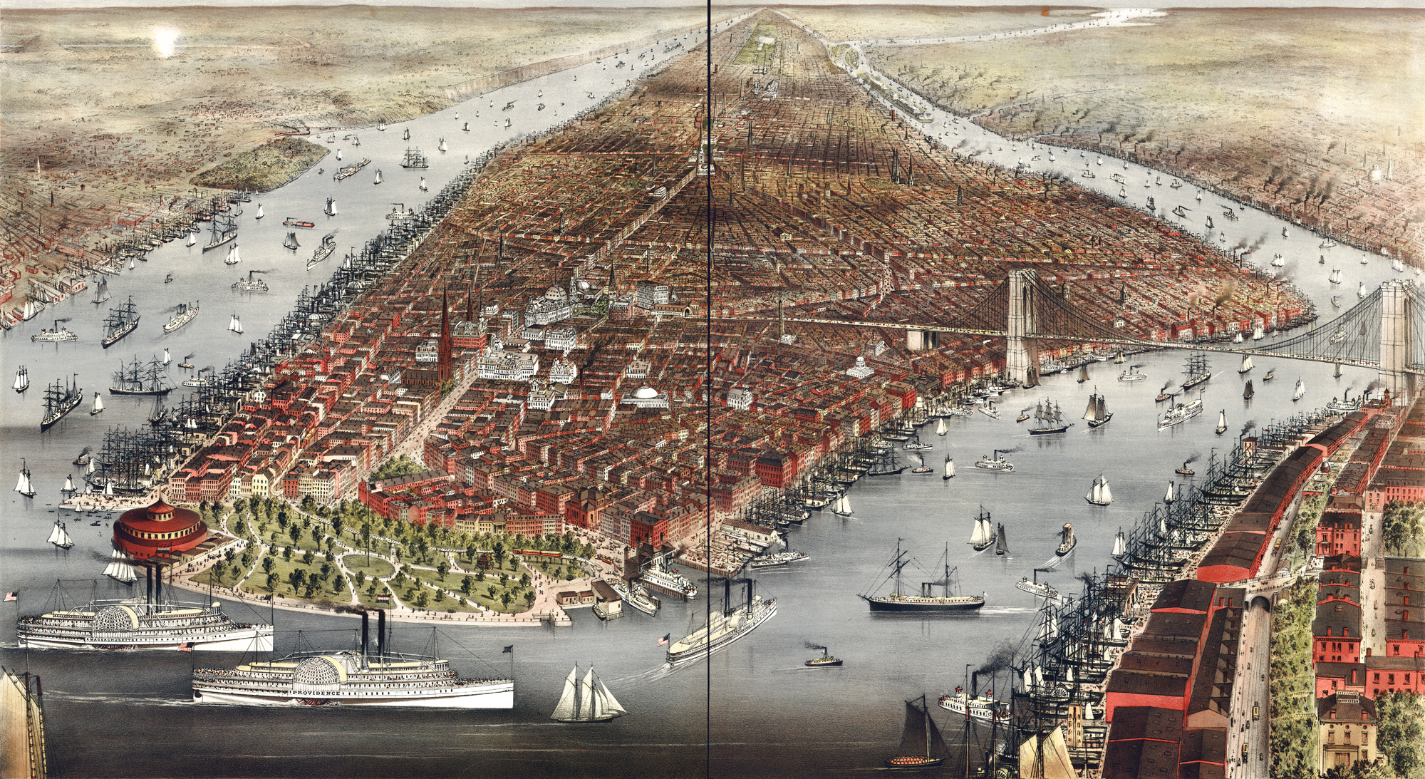
City of New York, Perspective Map - 1876
Panoramic illustration of the City of New York not drawn to scale. Contributors: Parsons & Atwater, Currier & Ives. Published by Currier & Ives, New York, ©1876. Source: Library of Congress Geography and Map Division.
Nathaniel Currier established a New York-based lithography firm in 1835 and produced thousands of prints in that together create a vivid panorama of the mid-to-late 19th century life and history of New York and other cities. . Later, Nathaniel included his brother Charles in the business, and in 1857, Currier made James Merritt Ives (Charles's brother-in-law) a business partner.
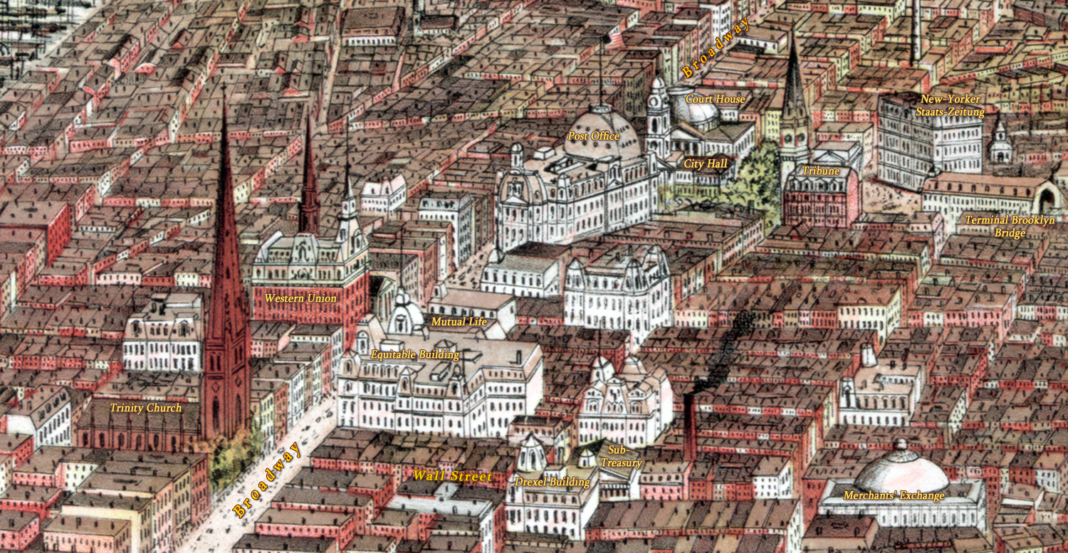
Engraving shows points of interest, including the Post Office, City Hall, Battery Park and more. The Brooklyn Bridge was still under construction at the time and was opened to traffic on May 24, 1883. Below, enlargement of the center of image.
More: Historical maps of New York City ►


Notable buildings in Lower Manhattan including some early skyscrapers in the City, like the Tribune, the Equitable Building, the Western Union, the Mutual Life Building. The terminal of the Brooklyn Bridge is represented here, but the Bridge was opened to traffic years later, in 1883.

City of New York, Perspective Map - 1876
|
Copyright © Geographic Guide - 19th Century NYC. Historic Buildings. |