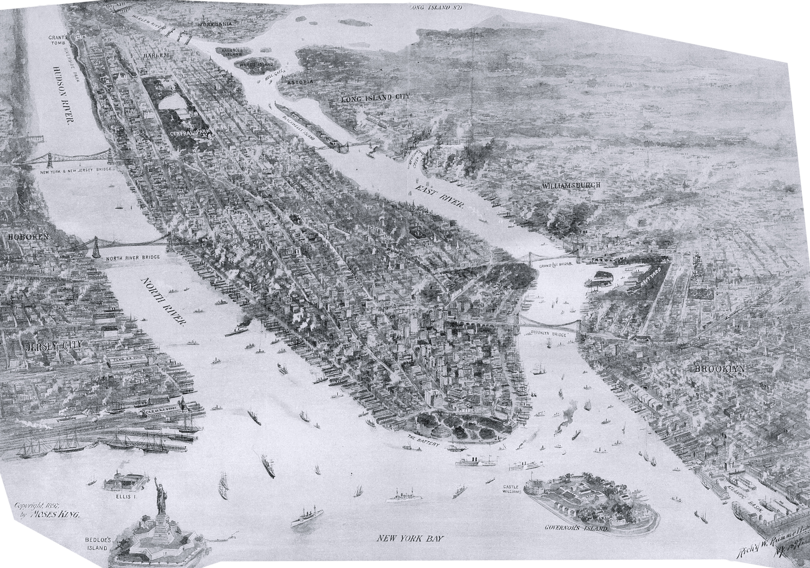
Bird's Eye of City of New York - 1897
Bird's-eye view of New York City by Richard W. Rummell (1848-1924), copyright 1897 by Moses King. Source: Phillips Academy, Digital Commonwealth.
Illustration shows Manhattan Island, with Jersey City on the left and Brooklyn on the right. Notable places includes Bedloe's Island (Liberty Island), Ellis Island, North River Bridge, Governors Island, New York Bay, Williamsburgh, Navy Yard, Blackwell's Island (now Roosevelt Island), the Battery, Grant's Tomb (Riverside Park), Central Park, Long Island City, Astoria, Harlem and others.
In 1898, the City of New York expanded to its present boundaries, including its five boroughs: the Bronx, Brooklyn, Manhattan, Queens, and Staten Island.

|
Copyright © Geographic Guide - 19th Century NYC. |
Bird's Eye of City of New York - 1897