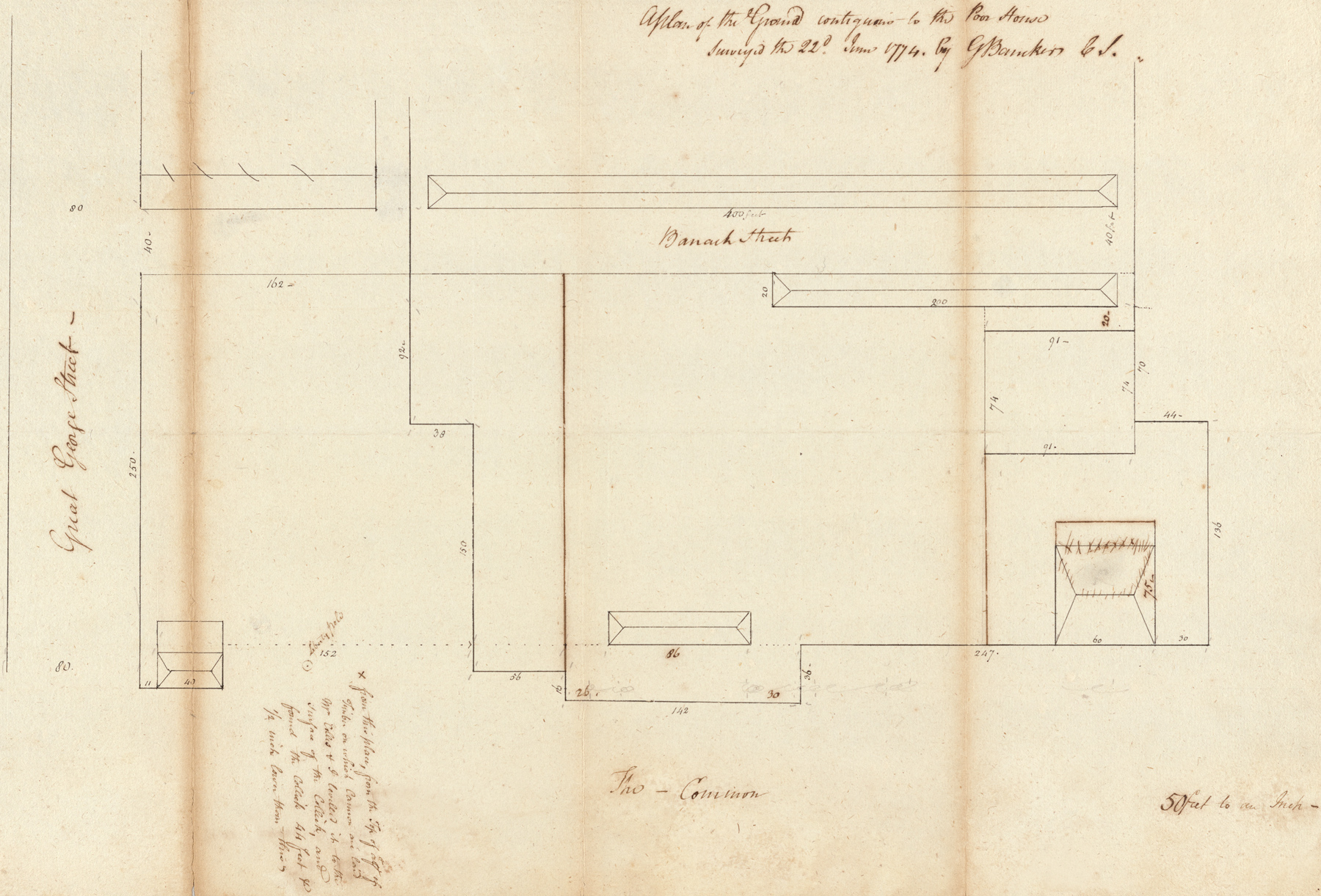
Plan of the Ground Contiguous to the Poor House by Gerard Bancker, 1774
The Almshouse building was erected in the Common by 1736, on a plot adjoining the John Harris property (left). It was New York City's first public institution to care for the poor, popularly called the Poor House. The Minutes of the Common Council, in 1735, indicated that it would be a workhouse as well. The Common Council ordered a garden to be fenced, plowed up, and kept for growing roots, herbs etc. In May 1739, the City ordered the construction of a small hospital. In 1746 the City ordered an enlargement of the Almshouse.
This map also indicates the location of the fifth pole erected on ground bought by Isaac Sears. The house on the left was the John Harris house. The building on the right was the Gaol (prison). The building in the center is the Poor House. The barracks of the British soldiers is on the top. The Great George Street, on the left, became officially part of Broadway in 1794. The "Barrack Street" extended east from the Great George Street (Broadway) within the present Park area, between Warren and Chambers streets.
More: Maps of NYC - 18th Century ►
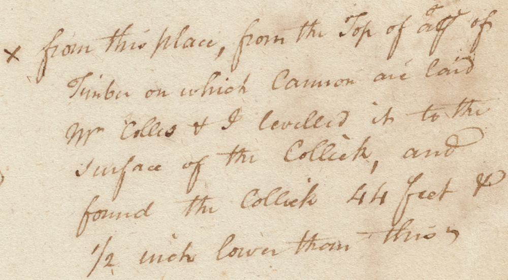
Original title: Plan of the Ground Contiguous to the Poor House, surveyed the 22d June 1774, by Gerard Bancker, C S. Source: New York Public Library. It was "made to enable the Committee to fix on a Suitable place for the Water Works" (the City's first water system) and "To levelling in Co: with Mr Colles from the Liberty Pole to the Calk".
Gerard Bancker (1740-1799) was a city surveyor and politician born in Albany, New York, son of Gerard Bancker (Sr.) and Maria de Peyster. He was grandson of Johannes de Peyster (1666–1719), the 23rd Mayor of New York City, between 1698 and 1699. In 1772, he was elected to the American Philosophical Society (Philadelphia). Gerard Bancker worked as city surveyor from 1772 to 1775. He was Deputy Treasurer from 1776 to 1778, and New York State Treasurer from 1778 to 1798.


Enlargement of the text.

Also by Gerard Bancker.
|
Copyright © Geographic Guide - 18th Century NYC, Historical Maps. |