Broad Street Map and Surroundings - 1894
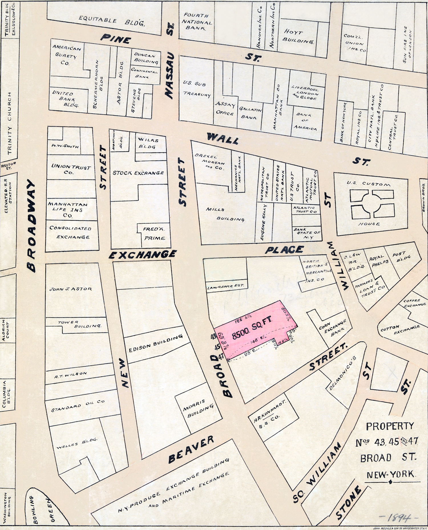
Original title: Property Nos. 43, 45 and 47. Broad St. New-York. Relevant property lots, with dimensions, are highlighted in pink. The map shows names of commercial buildings of the time, including the Morris Building, Edison Building, Mills Building, Drexel Building, the Stock Exchange, N.Y. Produce Exchange and maritime Exchange Building, Delmonico's at 56 Beaver Street, corner of William Street, Standard Oil Co. and Welles Building, the old Columbia Building at 29 Broadway, Aldrich Court at 45 Broadway and many others. Map covers area bounded by Pine Street, William Street, Stone Street and Broadway, in Lower Manhattan. On print: "John Medole & Son, 23 Vandewater St., N.Y." Year depicted: about 1894. Source: New York Public Library.
More: Historical maps of New York City ►

Broad Street Map and Surroundings - 1894
Western Union Building
|
Copyright © Geographic Guide - 19th Century NYC. Manhattan. |