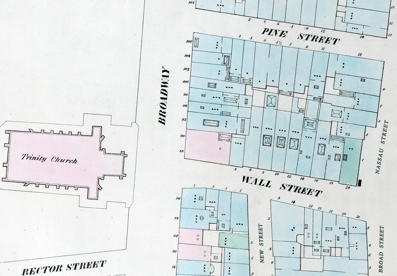
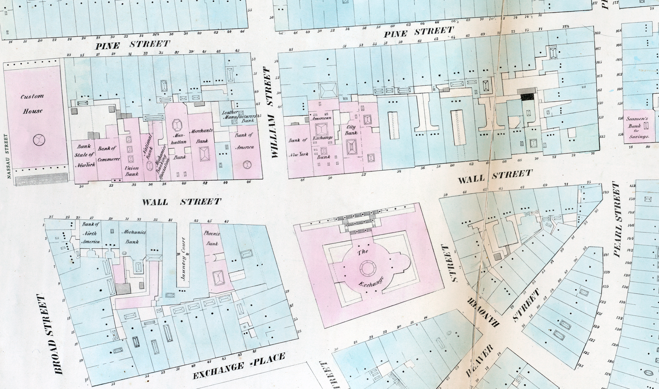
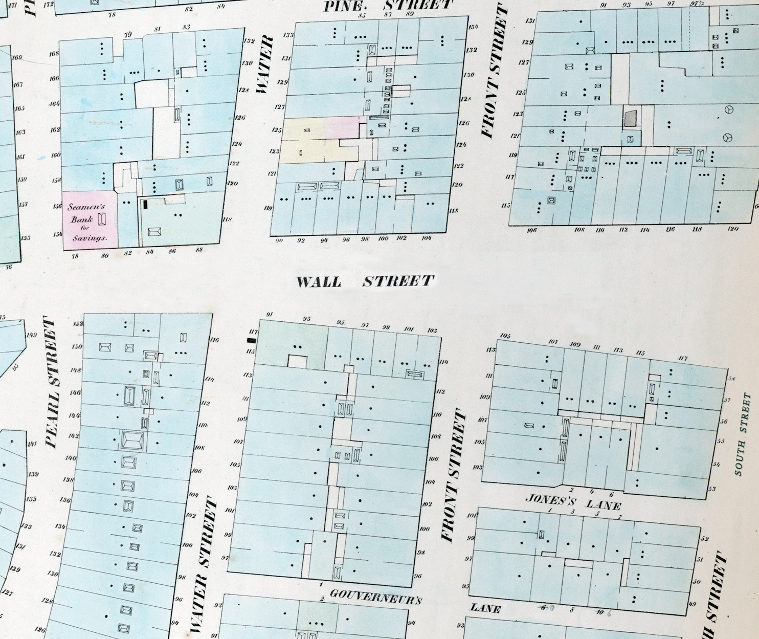
Map of Wall Street - 1852
Map of Wall Street, from Broadway to South Street. Fragment from the William Perris Maps of the City of New York, issued in 1852. Additional text in green. Source: New York Public Library.
Several banks were on Wall Street at the time, including the Bank State of New York, Bank of Commerce, Union Bank, National Bank, Manhattan Bank, Merchants Bank, Leather Manufactures's Bank, Bank of America, Bank of New York, Bank of North America, Mechanics Bank, Phoenix Bank, America Exchange Bank, City Bank, Seamen's Bank for Savings. In addition there were iconic buildings like the Exchange and the Custom House.
More: Wall Street at Broadway ►

|
Copyright © Geographic Guide - NYC in 19th Century. Historic Streets. |

At 88 Broadway


Map of Wall Street - 1852