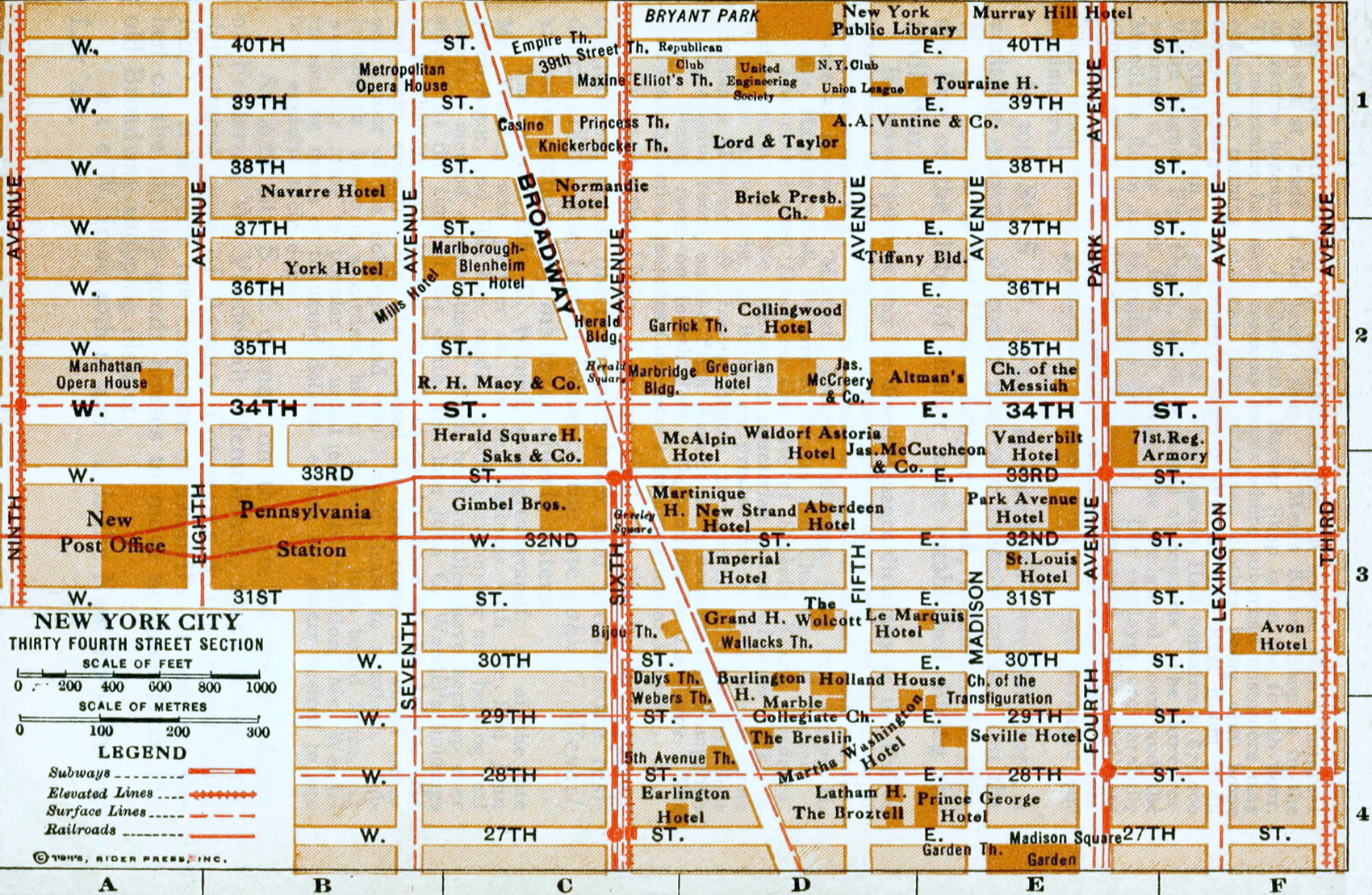
Map of Thirty-Fourth Street, Manhattan - 1915
Map of Thirty-Fourth Street, Manhattan from the Rider's New York city and vicinity, including Newark, Yonkers and Jersey City - a Guide-Book for Travelers, with 16 maps and 18 plans., compiled and edited by Fremont Rider. Published New York by Henry Holt and Company, 1916 by Rider Press. Map copyright 1915.
Map shows features of 34th Street section from Third Avenue to Ninth Avenue. It includes streets from 27th Street to 40th Street, transport lines and the names of important buildings of the time. Below, text from the Preface:
«The Borough of Manhattan is an island, bounded on the E. by the East River, and Harlem River, on the N. by the U. S. Ship Canal; W. by the Hudson River, coming to a point in the Battery, at the S. This island is about 13 mi. long with an average width of 2 mi. Including the islands, Blackwell's, Ward's, Randall's, and Governor's, it has an area of about 21.9 sq. mi. The lower half of the island is flat. The upper half slopes up from the Hudson to a higher ridge. The ground is almost solid rock, chiefly gneiss and limestone (...). Some idea of the amount of blasting necessary to sink the deep foundations of the sky-scrapers can be obtained from viewing the rocky ledges of blocks in the northern part of the city, not yet built upon.»
Geology: «The Island of Manhattan is in the main a ridge of gneiss, modified at its upper end by limestone belts and carrying on its surface an accumulation of sands, clays and gravel. In later stages, as the process of lithofaction proceeded, these deposits were carried up in almost vertical sheets and the fissures filled with granite and fused gneiss. Gneiss predominates on the west side of the island and graduates into mica schist on. the east, although no clear line of demarkation can be drawn. Gneiss as found in Manhattan varies from light gray to dark, the color depending on the relative quantities of black mica, granite and feldspar present. In some varieties solid ribbons of spar quartz are found alternating with narrow strips of mica.
This foundation of gneiss extends beneath the mud of New York Bay, reappears in Governor's Island, underlies Long Island and Staten Island, constituting the earliest and basal geological foundation.»

|
Copyright © Geographic Guide - 20th Century, Cartography, Old Maps NYC. |

Map of Thirty-Fourth Street, Manhattan - 1915