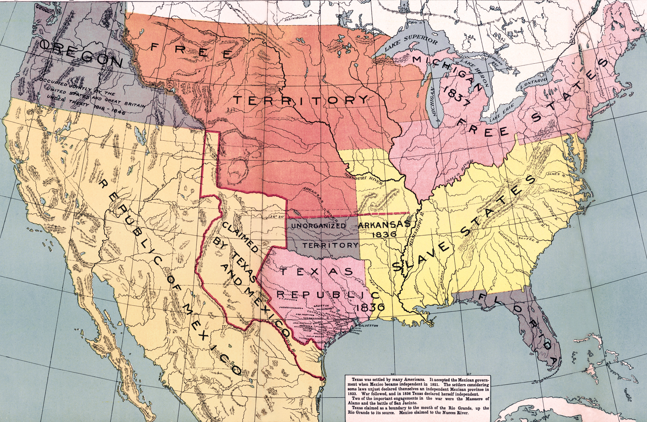
Historical map of the United States of America, Republic of Texas, Republic of Mexico and Oregon in 1837, also showing Free States, Slave States. Source: McConnell's Historical Maps of the United States, 1919 / Library of Congress Geography and Map Division Washington, D.C.
 Text that accompanies this map:
Texas was settled by many Americans. It accepted the Mexican government when
Mexico became independent in 1821. The settlers considering some laws unjust
declared themselves an independent Mexican province in 1833. War followed, and
1n 1836 Texas declared herself independent. Two of the important engagements in
the war were the Massacre of Alamo and the battle of San Jacinto. Texas claimed
as a boundary to the mouth of the Rio Grande, up the Rio Grande to its source.
Mexico claimed to the Nueces River.
Text that accompanies this map:
Texas was settled by many Americans. It accepted the Mexican government when
Mexico became independent in 1821. The settlers considering some laws unjust
declared themselves an independent Mexican province in 1833. War followed, and
1n 1836 Texas declared herself independent. Two of the important engagements in
the war were the Massacre of Alamo and the battle of San Jacinto. Texas claimed
as a boundary to the mouth of the Rio Grande, up the Rio Grande to its source.
Mexico claimed to the Nueces River.
Oregon was then a large region of the Pacific Northwest of North America that was subject to a long dispute between the United Kingdom and the United States in the 19th century. In 1848, the U.S. portion of the Oregon Country was formally organized as the Oregon Territory.
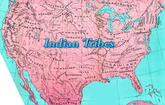
The U.S. Government used treaties as one means to displace Indians from their tribal lands, a mechanism that was strengthened with the Removal Act of 1830, which provided "for an exchange of lands with the Indians residing in any of the states or territories, and for their removal east of the river Mississippi".