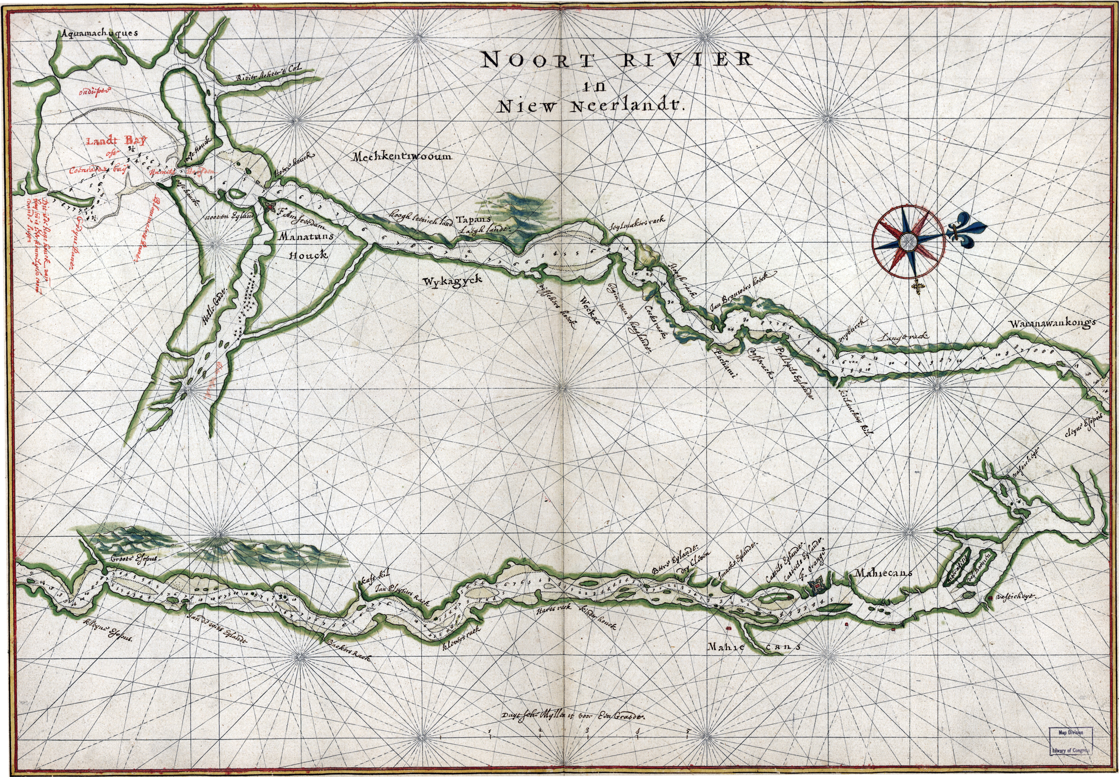
Map of New Amsterdam in 1639 - Noort Rivier in Niew Neerlandt
Map of New York in the 17th Century. It shows the Hudson River ("Noort Rivier") from Manhattan Island to Albany, natural features and other geographical entities in the region. Language: Dutch / Flemish. Source: Library of Congress Geography and Map Division.
It is attributed to Joan Vinckeboons by comparison with his other Dutch maps. It is described in Terrae incognitae, v. xvi, 1984. Richard W. Stephenson's The Henry Harrisse collection ... , p. 40; the third volume has binder's title "Manuscript maps of New-Netherland and Manhattan drawn on the spot by Joan Vingboons in 1639."
The Dutch colonies of New Netherlands were not solely fur trading outposts. Land was abundant and a steady stream of settlers acquired land and began producing basic agricultural products like bread, corn and meat. Gradually the New Amsterdam area also developed an agricultural hinterland that could both feed the traders and seamen in the city and also begin to export basic foodstuff to more colonies that exported cash crops.
More: Maps of NYC - 17th Century ►

More: Historical maps of New York City ►
More: New York in the 17th Century ►
|
Copyright © Geographic Guide - 17th Century NYC. Historic Maps. |
Map of New Amsterdam in 1639 - Noort Rivier in Niew Neerlandt
