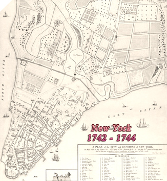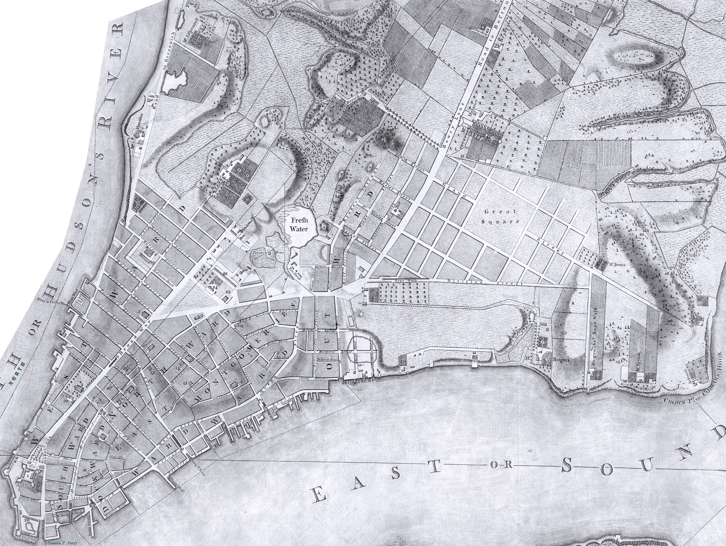
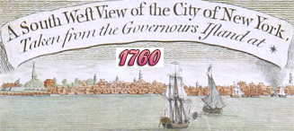
City of New York by Bernard Ratzer - 1767
Plan of the City of New York drawn by Bernard Ratzer [written "Ratzen", an engraver’s error], surveyed in 1767, engraved by T. Kitchin.
Original title / description: To His Excellency Sr. Henry Moore, Bart., Captain General and Governour in Chief in & over the Province of New York & the Territories depending thereon in America, Chancellor & Vice Admiral of the same. This Plan of the City of New York, Is most Humbly Inscribed, by His Excellency's Most Obedient Servant, Bernd. Ratzer. Lieutt in 60th. Regt. Survey'd in 1767. Published by Jefferys & Faden, 1776, in London. Source: Library of Congress Geography and Map Division. Map was cut to fit in this web page. Enlargement and references below.
There is also this similar map surveyed in 1766 and 1767 Bernard Ratzer, which is believed to be a later version.
|
Copyright © Geographic Guide - 18th Century Maps, City of New York. |
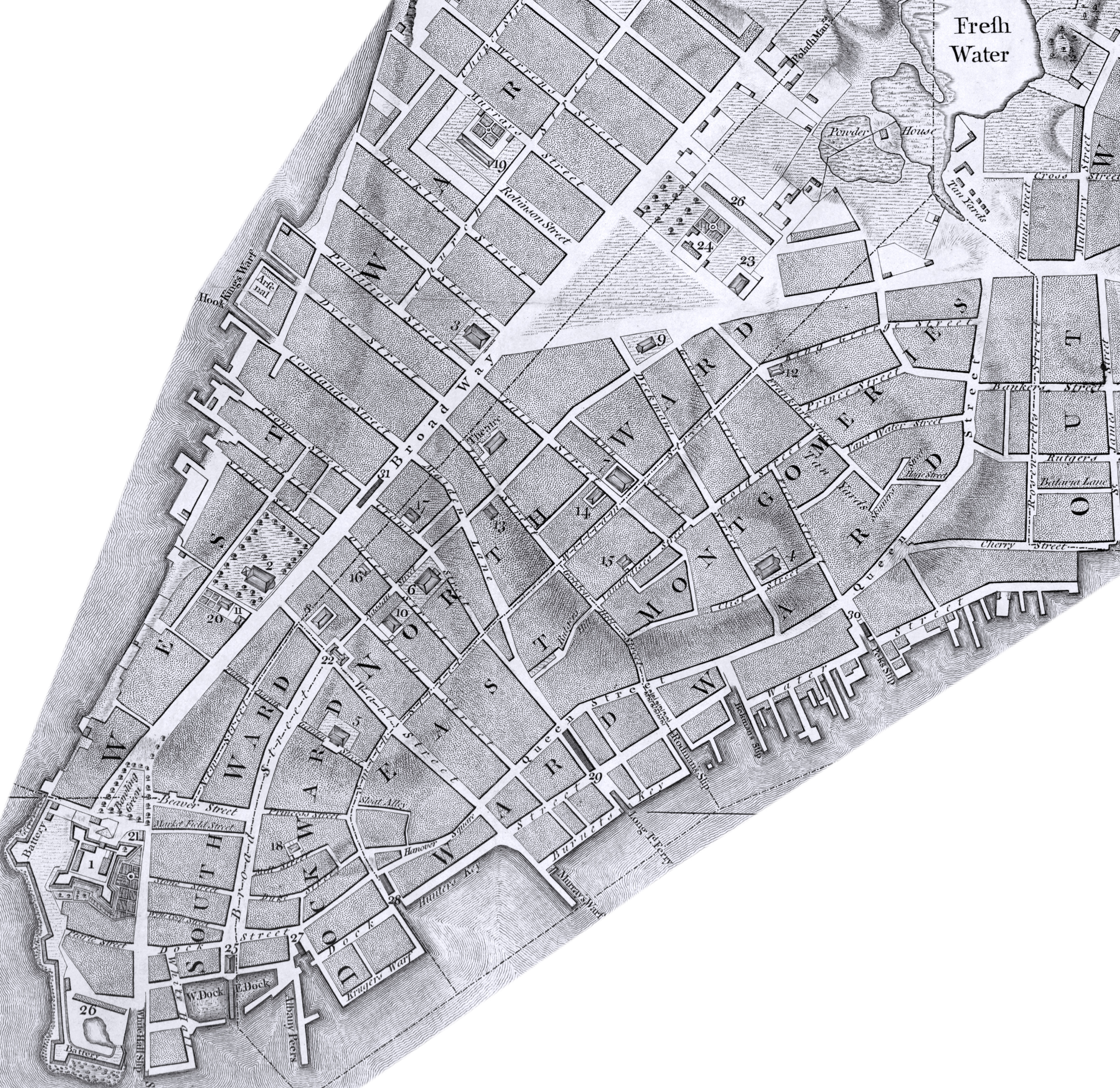
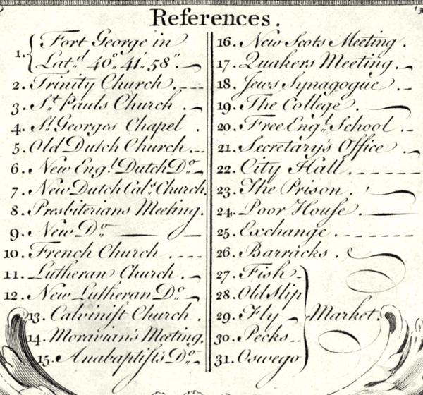
References published in the Plan:
1 - Fort George in Latitude 40º 41' 58".
2 - Trinity Church (first temple).
3 - St. Paul's Church (first temple).
5 - Old Dutch Church, known as Garden Street Church.
11 - Lutheran Church (third temple, consecrated in 1729).
19 - [King's] College.
25 - [Royal] Exchange.

City of New York by Bernard Ratzer - 1767


Liberty Pole in the Fields, now City Hall Park.