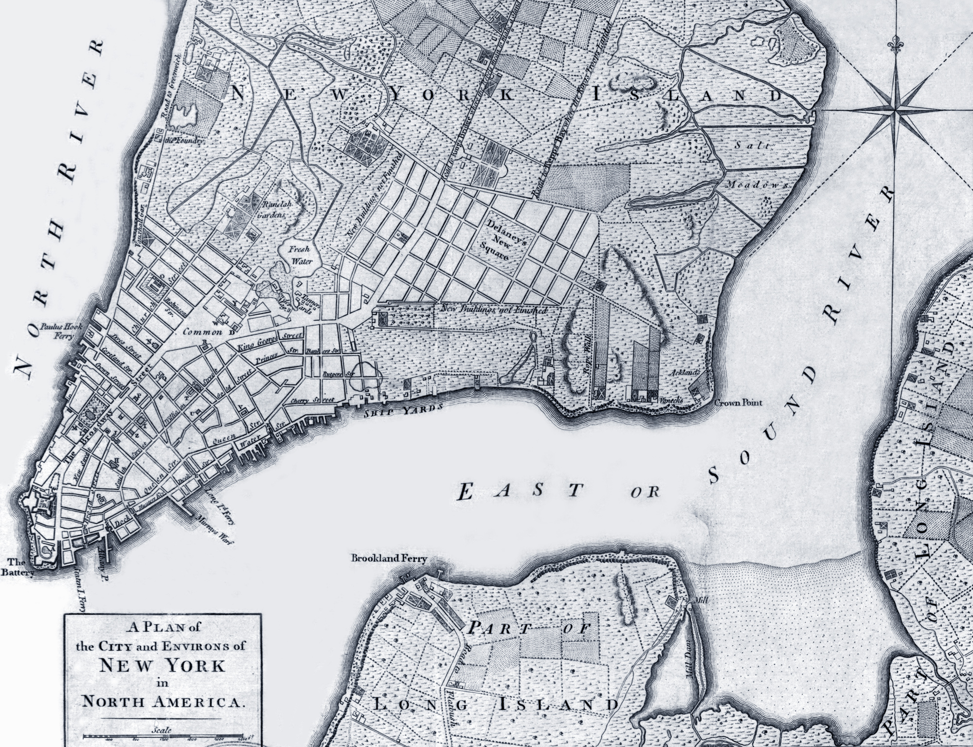
Map of New York - 1776
Original title: A Plan of the City and Environs of New York in North America, published by John Hinton in London, 1776. Text on print: London, Published according to Act of [British] Parliament, January 12; by Jefferys & Faden, Corner of St. Martins Lane, Charing Crofs. Engraved by T. Kitchin. Enlargement of the center is below. Source: The Universal Magazine of Knowledge and Pleasure, London, Nov. 1776, v. 59 / Library of Congress. This map is similar to the Bernard Ratzer map surveyed in 1767 and published in 1776, in London and the Map by John Montresor (1775), also published in London.
Note: this Plan of New York was published in the Universal Magazine for November, 1776, to illustrate a "Concise History of the Origin and Progress of the present unhappy Disputes between Great Britain and the American Colonies", a few weeks after the British took over the City of New York (September 15, 1776) and the Great Fire had burn down several buildings in the City (September 21), including the Trinity Church. The Plan does not seem to reflect the damage of the fire. Travel from America to England at that time could take more than four weeks. However, the fire was mentioned in the same issue (November) of the Magazine in a kind of addendum, between square brackets, after the "Concise History".
Description: general street map showing selected letter-keyed buildings in built-up area and field lines with generalized land use in rural areas. Relief shown by hachures. Also shows "Road to Kings Bridge where the Rebels mean to make a stand" and "Road to Kepps Bay where the Kings troops landed". Also covers rural part of Manhattan Island up to present-day 14th Street and small parts of Long Island. More: Map of the Great Fire of 1776 ►
More: Historical maps of New York ►
|
Copyright © Geographic Guide - 18th Century NYC. Historical Maps. |
References as published in the Magazine:
A - Military Hospital.
B - Fort George.
C - Secretary's Office.
D - The Prison.
Officially registered on January 12, 1776.
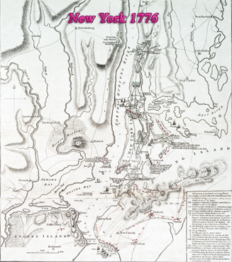
Plan of N. Y. Island, with part of Long Island, Staten Island and east New Jersey, with disposition of both the armies, British and American.

E - Public Market.
F - The Exchange.
G - Jews Synagogue.
H - Old Dutch Church.
I - New Dutch Church.
J - City-Hall.
K - Trinity-Church.
L - Lutheran Church.
M - English Free-School.
N - St. Paul's Church.
O - The College.
P - Quakers Meeting.
Q - The Theatre.
R - Presbyterian Meeting.
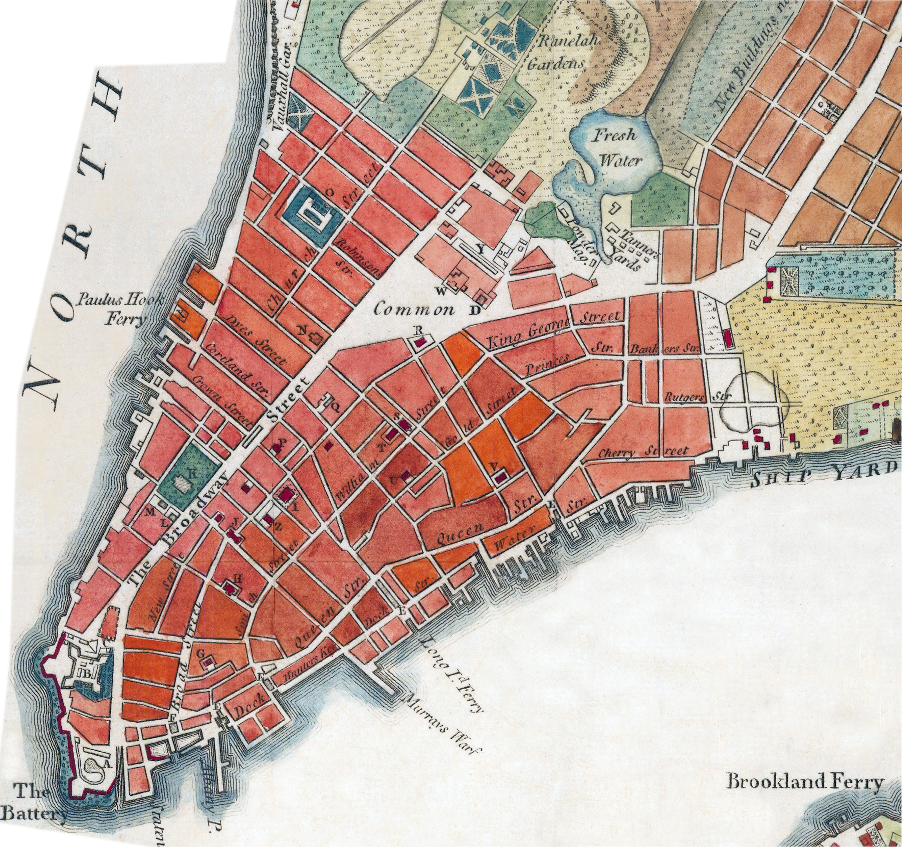
Below, a fragment of a hand-colored version of the same map (the original one was black and white),
S - New Dutch Calvinist Church.
T - Moravian ditto.
U - Anabaptist Meeting.
V - St. George's Chapel.
W - The Poor House.
X - The Arsenal.
Y - The Barracs.
Z - French Church.


Map of New York - 1776