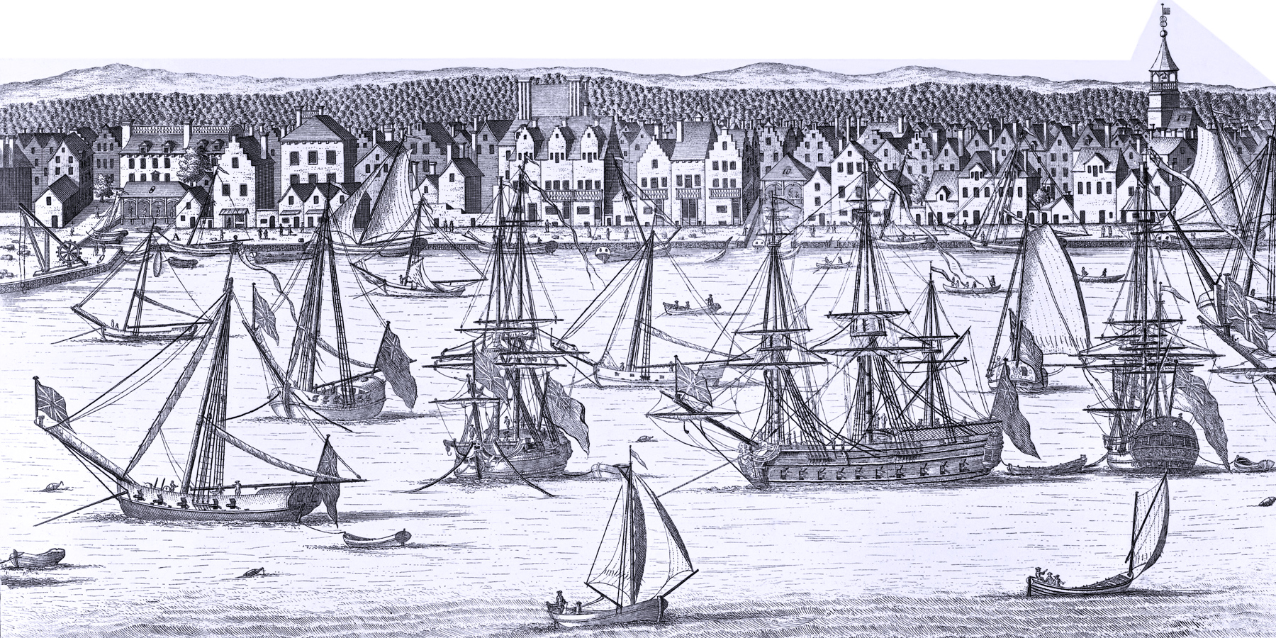
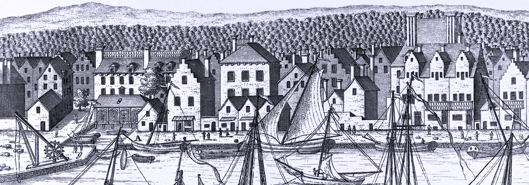
South Prospect, City of New York
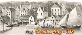
This second plate shows the wharf (A) from the Coenties Slip (left) to a point south of the foot of Wall Street. At the time, the East River shoreline in this area was characterized by an almost continuous network of wharves and slips, built increasingly further out into the East River. Enlargements of the buildings are shown below. Reference numbers included in this engraving, with comments from Stokes (Iconography of Manhattan Island, ... 1915):
"8 - The Lower Market." Coenties Market or Fish Market, established at Coenties Slip in 1691. Demolished probably in 1780, in May, 1781, its site was designated as “the place where Coenties Market stood”.
"9 - The Crane." The successor to the original crane or hoist, a conspicuous object in all the early views of New York, and which stood somewhat farther to the south.
"10 - The Great Flesh Market." Known later as Old Slip Market. Established April 18, 1691; built about 1701; enlarged in 1736; partially rebuilt in 1754, and demolished probably during the Revolution.
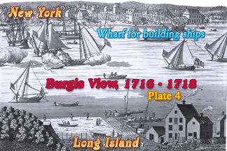
This is the second of the four plates of the original Burgis View of New York City, depicted between 1716 and 1718 by William Burgis, from Brooklyn Heights. Original title: A South Prospect of ye Flourishing City of New York in the Province of New York in America. Source: New York Public Library.
Burgis View: 1716 - 1718, Plate 2.
From Coenties Slip to the Burger's Path (Foot of William Street)
The house standing on the east side of Coenties Lane or Alley and on the north side of Pearl Street (47) belonged to Tobias Ten Eyck. It was a double dwelling under one roof, and remained in this family until 1784, when it was sold to Cornelius Ray, one of the most eminent New York citizens of his day. The north-east corner of Coenties Slip (48) was Conraet Ten Eyck’s property. The Ten Eyck heirs did not remove from this site until 1801. No. 49 belonged to Johannes Outman; No. 50 to Helena Griggs, and No. 51 to Jacobus Van Cortlandt. This last property included the large house which fronts on Queen (Pearl) Street, the small extension or gateway to the left of it, and the three small stores or buildings on the wharf. It remained in the possession of the Van Cortlandt heirs until 1775.
 Robert Livingston, the owner of No. 52, was at this period “of
Albany.” This wide lot, fronting on Pearl Street, on which appears the palatial
residence with the high roof and two stacks of chimneys, had been granted to
William Cox, in 1687, by the City. His widow married the notorious pirate,
Captain Kidd, whose relations with Robert Livingston were very close. In 1693,
Kidd and his wife, and in 1696 his wife’s brother, Samuel Bradley, conveyed
their holdings to Livingston, who, in 1725, died seized of the property shown in
the view.
Robert Livingston, the owner of No. 52, was at this period “of
Albany.” This wide lot, fronting on Pearl Street, on which appears the palatial
residence with the high roof and two stacks of chimneys, had been granted to
William Cox, in 1687, by the City. His widow married the notorious pirate,
Captain Kidd, whose relations with Robert Livingston were very close. In 1693,
Kidd and his wife, and in 1696 his wife’s brother, Samuel Bradley, conveyed
their holdings to Livingston, who, in 1725, died seized of the property shown in
the view.
Nos. 53, 53a, and 54 are three similar houses. The first belonged to Cornelius Van Horne, the second to Abraham Lakerman, and the third to Lawrence Wessells. Garrett Duyckinck owned No. 55. When the picture was made, Marten and Albertus Clock, heirs of Tryntie Clock, were the owners of Nos. 56 and 57.
From Burger's Path to Wall Street
Leonard De Klyn built on lot 58 in the year 1709; the building was subsequently demolished by order of the Common Council in order to widen Old Slip for public use. When the slip had been so widened, Jacob Bolen’s house (59) became the corner house. Barent Rynders owned No. 60 and Paul Richard No. 61, which latter remained in the Richard family until 1796. Nos. 62, 63. These two buildings, which had belonged to James Graham, Attorney-General of the Province, were sold by his executors in 1711 to the heirs of Peter Short, in whose possession they were at the period of the view. Andries Coeyman and Gertrude, his wife, were the owners of No. 64, which the latter had inherited from her father, Samuel Staats, “Chyurgeon”. Nos. 65 and 66 belonged, respectively, to John Wandelaer and Albertus Bosch, No. 67 to Henry Courten or Coerten and No. 68 to Andrew Fresneau. Henry Carmer, Jr., was the owner of No. 69, which remained in the Carmer estate until 1772. No. 70 was the property of Robert Sinclair’s widow, Mary. Captain John Theobald owned and occupied the corner (71), referred to in many deeds and water-grants as “Captain Theobald’s Corner.”
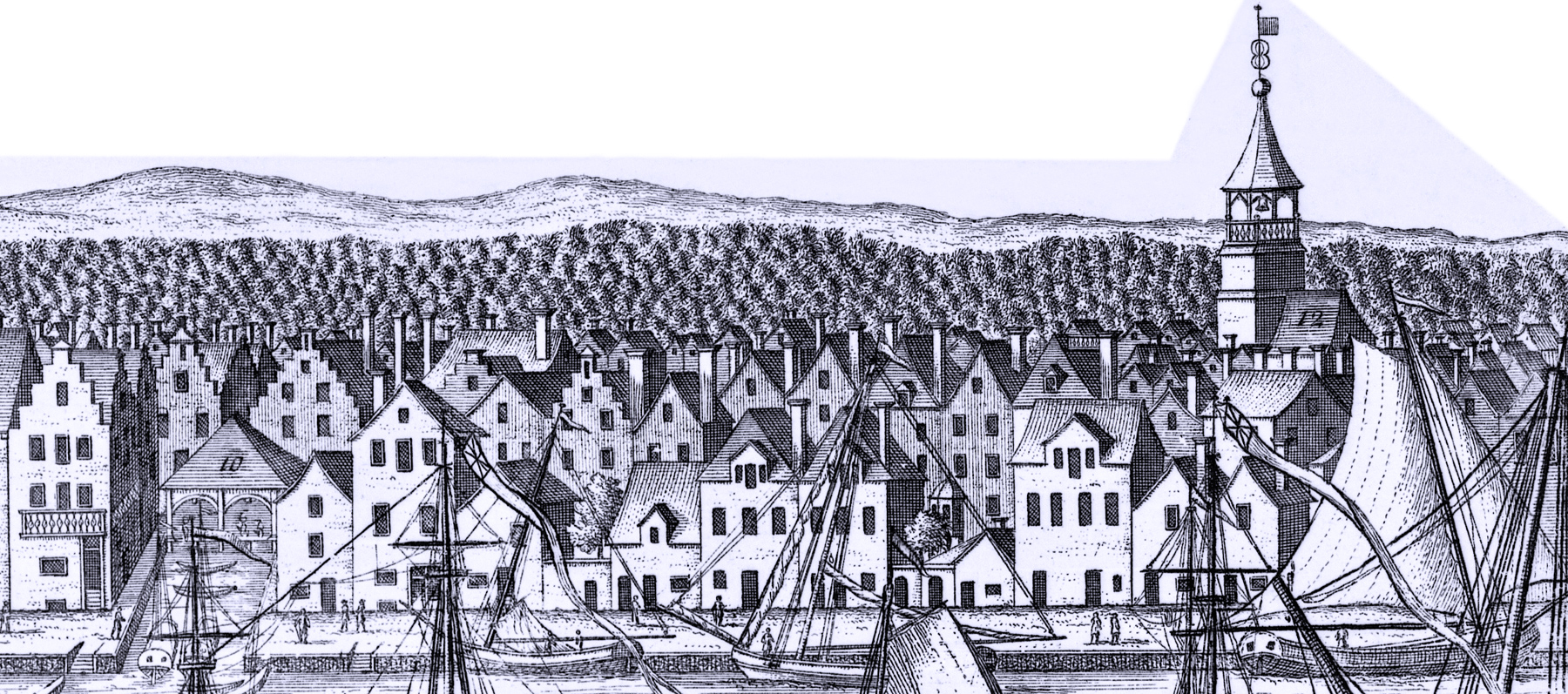
"11. The City Armes supported by Peace."
"12. The Dutch Church." The South Dutch Church on Garden Street (Exchange Place). Built in 1692; tower added in 1696; tower rebuilt from the ground in 1766-76; partly destroyed during Revolution; rebuilt in 1807; finally destroyed in the Great Fire of 1835.
Based on the Burgis View.

10 - Great Flesh Market

Dutch Church
8 - Lower Market / A - Wharf.
|
Copyright © Geographic Guide - 18th Century Waterfront NYC. Historic Images. |
South Prospect, City of New York