
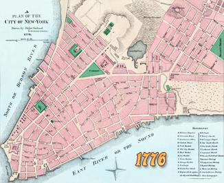
Topographical Map of Northern New York Island - 1776
Title: A Topographical Map of the Northern Part of New York Island, exhibiting the plan of Fort Washington, now Fort Knyphausen, with the rebels lines to the southward, which were forced by the troops under the command of the Right Honorable Earl Percy, on the November 16th 1776, and surveyed immediatly after by order of his Lordship, by Claude Joseph Sauthier. To which is added the attack made to the northward by the Hessians. Surveyed by order of Lieutenant General Knyphausen.
Date depicted: 1776. Published by William Faden, 1777. Source: New York Public Library.
According to Stokes (Iconography of Manhattan Island, ... 1915), this is the most accurate map of the upper end of Manhattan Island at the time of the Revolution. This map is found in the Faden Atlas of 1777. An advertisement of this map in The New-York Gazette; and the Weekly Mercury, of December 9, 1776, describes it as ‘‘exhibiting all the Grants of Lands made in that Province with The Proprietors Names inserted on each Grant: Compiled from actual Surveys by Claude Joseph Sauthier,” etc.
More: Maps of NYC - 18th Century ►
|
Copyright © Geographic Guide - 18th Century Maps, City of New York. |
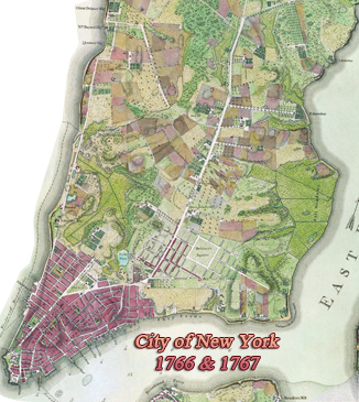
The British took over New York City on September 15, 1776. Howe's army attacks Manhattan at Kip's Bay, where a Connecticut militia unit flees in fear and confusion. Washington writes Congress, calling the rout "disgraceful and dastardly conduct," and describing his own efforts to halt it. On September 16, the same unit redeems itself in the battle of Harlem Heights. In his September 17 general orders, Washington praises the officers and soldiers, noting the contrast to the "Behavior of Yesterday" (George Washington to Congress, September 16, 1776).
On September 24, Washington wrote Congress on the obstacles to creating a permanent, well-trained Continental Army to face the regulars of the British Army and described his frustrations in employing local militia units. He closed by acknowledging the traditional fears of a "standing army" in a republic but urges Congress to consider that the war may be lost without one.
On October 16, Washington ordered the retreat of the army off Manhattan Island. New York City is lost to the British. General William Howe wins a knighthood for his successes in the campaign of 1776.
After the peace agreement was signed, the British evacuated New York on November 25, 1783.


Topographical Map of Northern New York Island - 1776